A few postings back, I shared photos and a video of our recent hike to Thimble Peak. This was a twelve-mile hike from the Gordon Hirabayashi Campgrounds, where we took the Sycamore Reservoir trail to the Bear Canyon trail, then on the Thimble Peak trail and back, all under windy but beautiful weather. A good part of this hike was in the Push Ridge Wilderness area of the Santa Catalina Mountains
A week later, the SCVN Friday hike was scheduled from Sabino Canyon to Hutch’s Pool, with the option of taking the East Fork trail to Bear Canyon trail, looping back to Sabino Canyon Center. The loop hike is also a twelve-mile hike through the Push Ridge Wilderness, this time continuing on the Bear Canyon trail through the Seven Falls area of Bear Canyon. The significant difference for this hike was the contrast of a cloudy day vs. the blue sky weather a week earlier– both were very alluring hikes.
Near The Start Of The East Fork Trail — Images and Video by kenne
At the fork where Box Camp Canyon merged into Sabino Canyon, six of us opted to take the East Fork to Bear Canyon, the others taking the West Fork to Hutch’s Pool. Once at the saddle between Sabino Canyon and Bear Canyon, we began heading south on the Bear Canyon trail. At this point, most of our hike through Bear Canyon was downhill.
Once we reached Bear Canyon Creek, the trail crossed it, running parallel to it, veering to the left where the creek runs into Seven Falls. The view above Seven Falls allows one to see all the trail switchbacks that are not visible from where the south part of the Bear Canyon trail leads to Seven Falls.
After hiking down through Bear Canyon, it’s hard to understand why anyone would hike to Thimble Peak through Bear Canyon, rather than coming from the Gordon Hirabayashi Campgrounds. The distance maybe a little less, but the gain would not be worth the elevation change.
The following video contains photos and video clips from the loop hike, November 15, 2013.
kenne
The Bear Canyon Trail comes in Next To Seven Falls, With Sun Light Peeping Through.
Panoramic Image from the Mountain Meadow Below Thimble Peak — Images by kenne
As Sabino Canyon Volunteer Naturalists (SCVN) we spend a lot of time in the Canyon and the Santa Catalina Mountains leading children and adults on outdoor activities. One of the iconic images of the Canyon is Thimble Peak. It can be seen from the Sabino Canyon Recreational Area Center, the tram ride up through the Canyon, Bear Canyon and many of the area’s hiking trails.
One very popular trail is Blackett’s Ridge trail located between Sabino Canyon and Bear Canyon. This difficult hiking trail ends about a mile from Thimble Peak, separated by a deep ravine — “So close, yet so far,” is the thought most people have when reaching the end of the Blackett’s Ridge trail. Serious rock climbers might venture on, but most adventurous hikers look for other options for hiking to this majestic pinnacle.
One option is to hike, or take the tram, up through Sabino Canyon, then taking the Sabino Canyon trail to the East Fork trail, looping around to the Bear Canyon trail.
Another option is to take the Bear Canyon trail out of the Sabino Canyon Recreational Area up through Bear Canyon passed Seven Falls.
A third option is the one that five SCVN members (Phil Bentley, Alexa Bieberstein, Tim Ralph, Ed Rawl and Kenne Turner)decided to do when learning that the elementary school class coming to the Canyon on November 7th had been cancelled.
Wash Leading Out Of The Gordon Hirabayashi Recreation Site (Historical WWII Prison Camp)
This option involved driving the Catalina Highway to the Gordon Hirabayashi Campgrounds, where under a beautiful blue-sky morning, we began the twelve-mile hike in cool temperatures, with a forecast of sunny warm temperatures in the afternoon — windy with gusts of 40 mph.
Tim, Ed, Alexa and Phil At The Sycamore Reservoir Trail Saddle (Part of the Arizona Trail)
The Arizona Trail, which runs from Mexico to Utah goes through the area making use of many existing trails in the Santa Catalina Mountains. As predicted, the winds were gusty.
Phil, Alexa & Tim
This sign at the saddle on the Sycamore Reservoir trail is a common site for those hiking to the Sycamore dam. On our way to Thimble Peak, we stopped at the dam for a break before continuing on to the Bear Canyon trail.
The Peak Is In Sight! (Phil, Alexa, Ed and Tim)
Even with the very windy conditions, it didn’t take long before we began shading layers of clothing.
Photo Taking Time (Phil and Alexa)
This scene is located where the Bear Canyon trail goes left down into the canyon to Seven Falls. After a few photos, we headed off to the right through a beautiful mountain meadow toward the trail that would take us to Thimble Peak.
Thimble Peak
We were now only a few hundred yards from the pinnacle. You can click here to see 44 images on my Flickr account of our hike in a full-frame slideshow.
In addition to many photos, I managed to take several video clips, which I have edited into a video posted on YouTube and inserted below. The video contains a special treat with naturalist Phil Bentley singing America the Beautiful overlooking the Tucson valley from the base of Thimble Peak pinnacle.
At The Base of Thimble Peak Overlooking the Tucson Valley (Ed, Phil, Alexa and Tim)
Alexa Climbing The Pinnacle (Thimble Peak)
A Thimble Full Of Life
All one needs
in life is a thimble full of this and that to experience life.
We determine
what makes up
THIS, what makes up
THAT.
Hiking Blackett’s Ridge — Images by kenne (Click on any of the images to view in a slide show format.)
One of the most popular and difficult trails in Sabino Canyon is the Blackett’s Ridge Trail. The is 6.2 miles with an elevation change of 1810 feet. Starting at the Sabino Canyon Visitor’s Center, the trail attracts runners and hikers alike, some making the trek several times a week. As part of a published hiking schedule, the Sabino Canyon Volunteer Naturalists (SCVN) lead, hikers up to the trail’s end, providing a close-up wow-view of Thimble Peak, the canyon riparian area and the Tucson valley. Once up on the ridge, first time Blackett’s hikers begin to feel as if the trail will never end with several up and down climbs before finally getting the trail’s end in site.
Often at the end of the trail, chipmunks will greet the hikers. This behavior occurs because some good intending hikers wrongly feed our little friends. On this particular hike, a Cooper’s Hawk soured above the canyon.
kenne
“There is an ecstasy that marks the summit of life,
and beyond which life cannot rise.
And such is the paradox of living,
this ecstasy comes when one is most alive,
and it comes as a complete forgetfulness that one is alive.”
One of the most popular hikes in the Sabino Canyon Recreation Area is the trail to Seven Falls in Bear Canyon. The trail to the falls crosses the Bear Canyon creek seven times (seven crossing to seven falls). Usually there is water in the creek, adding to the hiking adventure.
Last Thursday, Ed Rawl, Jan Labiner and I hiked the trail from the Bear Canyon road entrance to the Sabino Canyon Recreation Area. Even after 19 inches of rain during the monsoon season (July, August, September), the creek is dry. There is some water at the falls, but it disappears underground once down in the canyon.
The now over eleven-year drought continues to impact the Sonoran Desert ecology. As pointed out in previous posting, invasive plants are competing for water in these drought conditions, i.e., fountain grass and buffelgrass. You can learn more about these and other invasive species at “Invaders“, a project of the Arizona-Sonora Desert Museum.
One Of The Bear Canyon Creek Crossings With Water Flowing, April, 2013 — Image by kenne
Hiking the Seven Falls Trail, October, 2013, No Water In The Creek (Click On Any Of The Tiled Photos For Larger Slideshow Image) — Images by kenne
The hike to seven falls, to and from, is about eight miles, crossing the creek seven times. The water flow is low since the winter snow and rain has been below normal.
It is a popular hike, especially during spring break.
One word (after the sun) that best describes our past, present and future is water. Currently, in the Sabino Canyon Recreation Area the mountain runoff is restarting nature’s wonderful cycle. Other than the fact it almost took my D800 the other day, I love being in its presence. Maybe I need to reduce my “risk factor.”
 Near The Start Of The East Fork Trail — Images and Video by kenne
 The Bear Canyon Trail comes in Next To Seven Falls, With Sun Light Peeping Through.

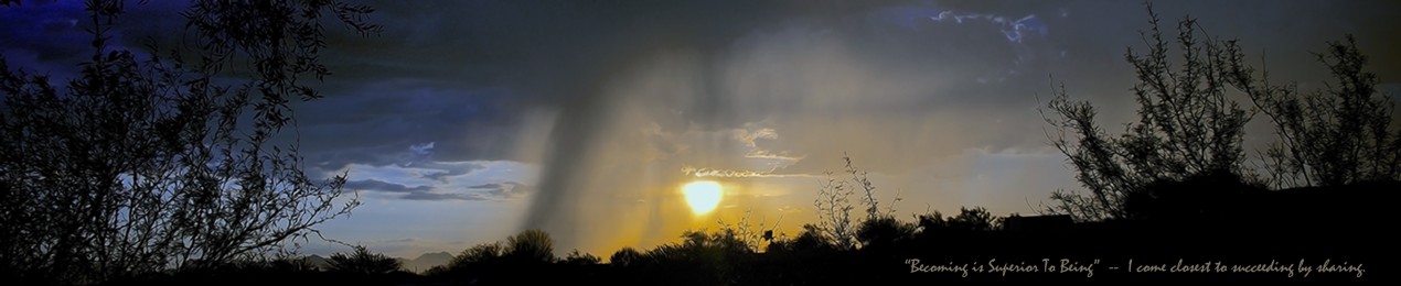
 The Sun Peaks Through The Clouds Above The Seven Falls Ridge And The Bear Canyon Trail Coming From The Upper Canyon
 Panoramic Image from the Mountain Meadow Below Thimble Peak — Images by kenne
 Wash Leading Out Of The Gordon Hirabayashi Recreation Site (Historical WWII Prison Camp)
 Tim, Ed, Alexa and Phil At The Sycamore Reservoir Trail Saddle (Part of the Arizona Trail)
 Phil, Alexa & Tim
 The Peak Is In Sight! (Phil, Alexa, Ed and Tim)
 Photo Taking Time (Phil and Alexa)
 Thimble Peak
 At The Base of Thimble Peak Overlooking the Tucson Valley (Ed, Phil, Alexa and Tim)
 Alexa Climbing The Pinnacle (Thimble Peak)
 Beautiful Grass Meadow Along The Trail To Thimble Peak (In the distance to the left.) — Panoramic Image by kenne


 “Still Adding Color To The Trail” — Images by kenne
 One Of The Bear Canyon Creek Crossings With Water Flowing, April, 2013 — Image by kenne


 Fountaingrass in Bear Canyon — Image by kenne

 Buttonbush Near Bear Canyon Creek — Images by kenne


-2 blog")
-27 blog")


 Art II blog")

 blog")

-5 blog")
 blog")

-5 blog")


-5 Balance Rock blog")


-2 blog")

 blog")

-5 blog")
 blog")


 art blog")


-2 blog")
-2 blog")

 blog")
-2 blog")

-2 blog")
-12 blog")
-5 blog")
-2 Two Nuns blog")


 blog")
-2 blog")
 blog")

-2 blog")
-6 blog")
 blog")
-9 blog")


-14 blog")


-4-2_contrast blog")


-4 blog")
-9 blog")
-3 blog")


 art blog")
-2 art blog")


 blog")

-6 blog")


 blog")
 art blog")

 blog")

 blog")
-17 blog")

-28 blog")

-3 blog")
-art blog")
-8 blog")
_painting blog")
-5 blog")
-33 Pine Leaf Milkweed Pod blog")
 blog")


 framed blog")

-4 blog")
-8 blog")

 art blog")


-11 blog")
-4 blog")
-2 blog")
-10 blog")


